
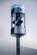


Paolo Corradeghini, surveyor at 3DMetrica, mapped two medieval cisterns beneath Castello Malaspina in Massa, Italy, with an Emesent Hovermap ST.
The full site visit, including rigging, safety setup and targets, took roughly four hours. The actual scanning took just 25 minutes. In Paolo's assessment, the SLAM algorithm held its trajectory through a narrow well and around people, and Emesent Aura merged three scans into one dataset covering the cisterns and the castle around them. He presented the project in an Emesent webinar in October 2026.
SLAM (simultaneous localization and mapping) is a method where a scanner measures its surroundings with a laser while working out its own position from the geometry it sees. It needs no GPS and no light, which suits a pitch-dark cistern.
How do you scan a cistern when the only way in is a narrow well?
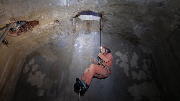 The castle has five cisterns under and near its courtyards. A team of local cavers, working on behalf of the Heritage Authority, surveyed all five with laser distance meters and compasses over three days. Paolo joined in February 2026 and scanned two of them with the Hovermap ST, partly to see how SLAM performs in a place like this.
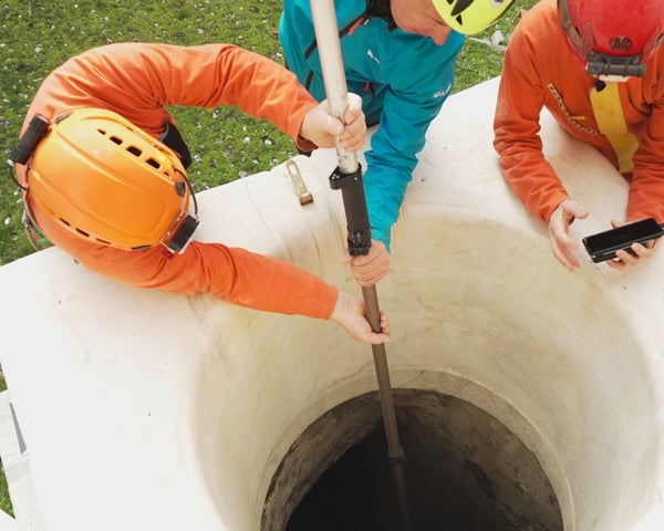
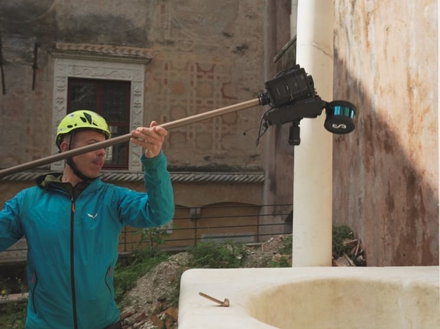
There was no special bracket, so he built a rig on site. He fixed the Hovermap carrying handle to the head of an extendable pole with cable ties, and secured the external battery beside the sensor. Fully extended, the pole reached about 3.5 meters, enough for these cisterns. A deeper shaft, he noted, would need a different setup. Before going underground, he walked a scan of about 10 minutes through the courtyards, stairs and passages, so each cistern could be placed in context. He followed a live preview in the Emesent Commander app on his phone.
Should the scanner go into the cistern alone, or with the operators?
Paolo tested both approaches on the same day. In the courtyard cistern, the scanner went down the well upside down on the pole while the team stayed outside. The scan took about five minutes. In his view this is the faster and safer option, because nobody enters a confined space. Its limit is shadowing: the scanner only sees what is visible from where it is lowered, so a wall hides what lies behind it.
In the kitchen cistern, operators climbed down a ladder and carried the pole into the room. That scan also took about five minutes. It needed more people with agreed roles, and it removed almost all of the shadow areas. His conclusion: the choice depends on the shape of the space and how safely people can get in.
Does the algorithm matter more than the hardware?
In Paolo's view, yes. He believes SLAM hardware has reached a plateau, with many systems using similar sensors, and that the algorithm now separates a reliable point cloud from no point cloud at all.
The neck of the well was his test. Moving from an open courtyard into a narrow tube leaves very little shared geometry. Every point in the cloud is placed using the scanner's trajectory, so drift in the path becomes error in the data. In the kitchen cistern, people near the sensor at the bottom of the shaft also hid geometry. His verdict: the algorithm passed. He processed the data in Aura with no constraints and let the SLAM run on its own.
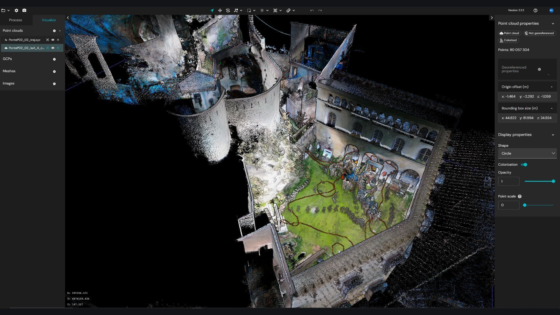
How do you georeference a scan when GNSS barely reaches the site?
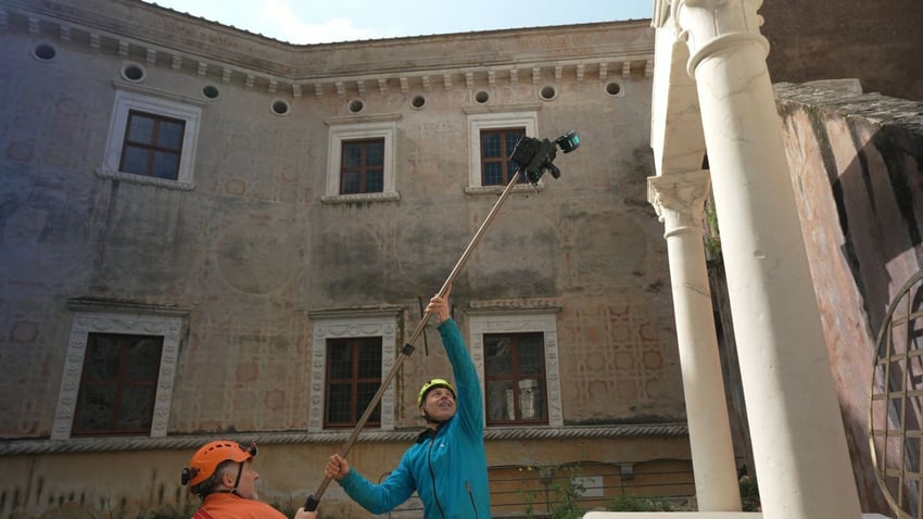
Georeferencing means tying a scan to real-world coordinates. Paolo placed at least four targets around each well. They worked as a safety net for aligning scans if the automatic merge had failed, and as control for georeferencing. The three scans were merged in Aura through their overlapping areas.
After scanning, he swapped the scanner for a GNSS receiver on the same pole and raised the antenna about four meters. High walls blocked much of the sky. Around the kitchen cistern the receiver didn't work at all, so not every target was measured. The ones that were measured had 4 to 6 centimeters of precision, and residuals on the targets came out at 4 to 5 centimeters, some at 6. Paolo attributes this to the GNSS precision, not the processing. He did the final georeferencing and accuracy checks in CloudCompare, along with manual clean-up of people who stood still during scanning.
How accurate can it be with good ground control?
Paolo answered this in the Q&A from his own tests with Emesent Hovermap and Aura on other jobs, not this project. When he used targets measured with a total station as constraints inside Emesent Aura, he reached 8 to 9 millimeters of accuracy and 5 to 6 millimeters of precision. His technique is to circle the targets with the sensor head pointing at them, to capture more points, and to use high-intensity targets that stand out in Aura. These are one surveyor's results under his own conditions, not a product specification.
Where does SLAM stop working?
Water. Some cisterns had 30 to 50 centimeters of water on the floor. The laser doesn't pass through water, and a flat, reflective, moving surface gives SLAM little to hold on to. One cistern was flooded to two or three meters, so cave divers surveyed it with a tape, an underwater compass and a depth gauge.
Paolo is fair about scope. The cavers' three days covered all five cisterns, including the flooded one. His four to four and a half hours on site covered two cisterns and their context, with about 25 minutes of actual scanning. The rest was logistics. His conclusion: the best result comes from using each method where it works best.
Audience Questions
To learn more, check out the webinar recording, available on-demand: Underground Versatility: Mapping a Medieval Castle's Cisterns with Emesent Hovermap ST