
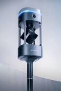


Emesent GX1 Launch Day Qatar 2026
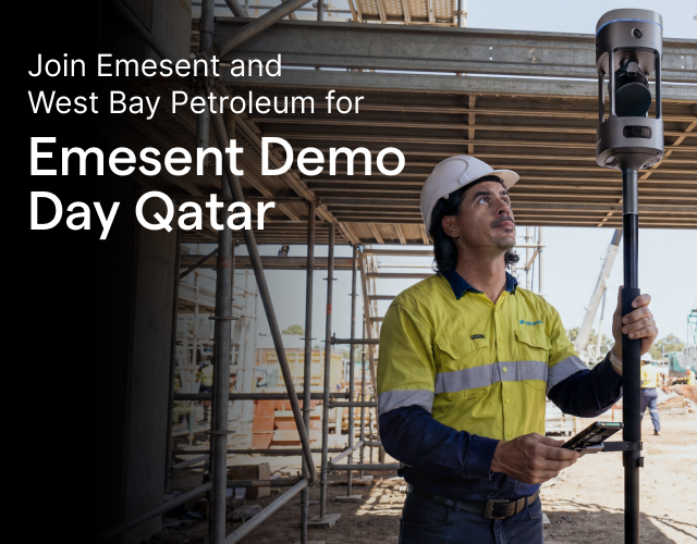
Join Emesent and West Bay Petroleum in Doha this September
Emesent and West Bay Petroleum, our official partner in Qatar, are hosting a complimentary Emesent GX1 launch day in Doha, giving you hands-on time with Emesent GX1, our newest all-in-one mobile mapping solution.
Head along to explore how SLAM-based LiDAR, 360° imaging and RTK come together in a single fast, accurate scanning workflow for AEC professionals, with hands-on time on the scanner built in throughout the day.
Date: Wednesday 23 September 2026
Location: Crowne Plaza Doha – the Business Park by IHG, 58 Street 310, Doha
Time: 10:00 a.m. - 2:00 p.m.
Registrations close Wednesday 16 September 2026.
What to expect:
-
Welcome and introductions - Meet the Emesent and West Bay Petroleum teams and hear how the day will run.
-
Latest Emesent updates - An overview of the newest features and capabilities across the Emesent product line.
-
AEC use cases - Real-world examples of architecture, engineering and construction teams using Emesent GX1 on active projects.
-
Live data collection demo - See Emesent GX1 paired with its companion tablet in action, then get hands-on yourself, with both indoor and outdoor scanning.
-
Post-processing walkthrough - Follow captured data as it moves through Emesent Aura and Aura Cloud into ready-to-use outputs, with an open Q&A to close things out.
-
Complimentary lunch - Provided on-site.
Our Technical Specialist, Dmitrii Naumenko, will be on-site for the duration to lead the live demonstrations, joined by Naved Ali, Emesent's Channel Sales Manager, who'll be on hand for any business-specific questions.
See how Emesent GX1 performs across different sectors:
-
Surveying: Emesent GX1 brings unmatched SLAM accuracy and richly detailed point clouds, simplifying georeferencing and removing manual steps along the way.
-
Construction: Detailed 3D models are quickly captured to support project design, planning and progress monitoring.
-
Architecture: Precise 3D scans of buildings and structures are produced for design, renovation and documentation work.
-
Government & public services: Disaster zones are rapidly mapped to support search and rescue, damage assessment and firefighting response.
Register now to secure your spot!