
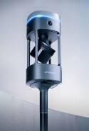


Emesent GX1 Demo Day South Korea 2026
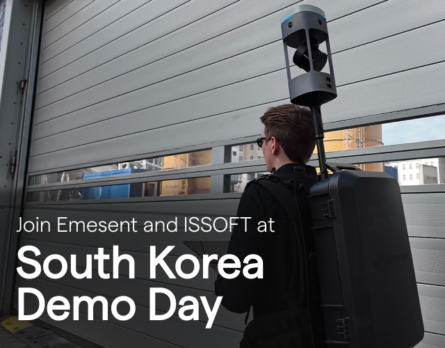
Join Emesent & partner ISSOFT this October
Proudly presented in partnership with ISSOFT, Emesent's official partner in South Korea, we're excited to invite you to a hands-on demo day dedicated to Emesent GX1, our new all-in-one mobile mapping solution.
Come see first-hand how SLAM-based LiDAR, 360° imaging, and RTK combine to deliver fast, accurate 3D data capture for AEC professionals.
Date: Thursday 22 October 2026
Location: Suwon Messe, 37, Sewha-ro 134beon-gil, Gwonseon-gu, Suwon-si, Gyeonggi-do, Republic of Korea
Time: 1:30pm - 5:30pm
What to expect:
You'll get a full walkthrough of the Emesent GX1 workflow — from live data collection to post-processing — plus the chance to try the scanner yourself.
- Emesent GX1 introduction & welcome: Meet the Emesent and ISSOFT teams and get an overview of the day ahead.
- Latest Emesent GX1 software updates: A walkthrough of the newest features and capabilities added to the platform.
- AEC use cases: See how architecture, engineering, and construction teams are putting Emesent GX1 to work on real projects.
- Live data collection demo: Watch — and try for yourself — how Emesent GX1 pairs with the companion tablet to capture data, with hands-on scanning sessions both indoors and outdoors.
- Complimentary catered lunch: Provided on-site by ISSOFT.
- Post-processing walkthrough: See how captured data moves through Aura and Aura Cloud into deliverable-ready outputs, followed by an open Q&A.
Our Technical Specialist will be on-site throughout to guide the live demonstrations and answer questions specific to your projects.
See how Emesent GX1 fits into different sectors:
- Surveying: GX1 delivers unmatched SLAM accuracy and richly detailed point clouds, streamlining georeferencing and cutting out manual steps.
- Construction: Capture detailed 3D models quickly to support project design, planning, and progress monitoring.
- Architecture: Produce precise 3D scans of buildings and structures for design, renovation, and documentation work.
- Government & public services: Rapidly map disaster zones to support search and rescue, damage assessment, and firefighting response.
Register now to secure your spot!