


The entrance to Actun Tunichil Muknal (ATM) is a deep blue pool at the base of a jungle cliff in western Belize.
To reach what lies beyond, you swim.
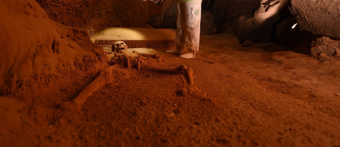
For over a thousand years, the ancient Maya made this journey - wading through chest-deep water, climbing over breakdown boulders, navigating passages that squeeze down to barely a meter high before opening into chambers that soar to 30 meters. They came to leave offerings: ceramic vessels, jade celts, grinding stones. And sometimes, people. The remains of 21 individuals still lie where they were placed, including the famous "Crystal Maiden" - a complete skeleton now encrusted in sparkling calcite crystals, glittering under torch light in a chamber 500 meters from daylight.
The cave's name translates to "Stone Sepulcher."
It earned it.
A Site Too Fragile to Lose
ATM cave is one of the most archaeologically significant Maya sites in Central America and one of Belize's most visited tourist destinations - featured on National Geographic, the History Channel, Discovery, and the BBC. But that fame comes with risk. Only 125 visitors are permitted daily, entering in groups of eight. Shoes are forbidden in the main chamber; socks required to protect the calcite floors. Wire barriers guard the Crystal Maiden.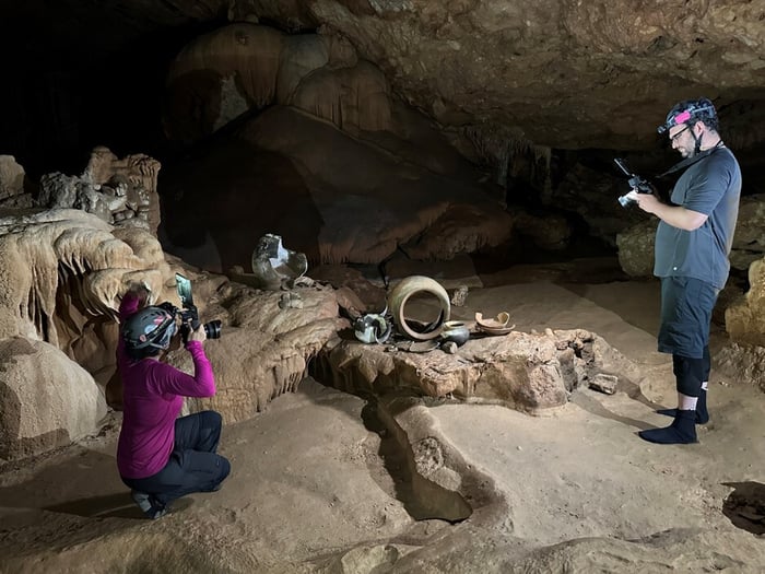 Despite these precautions, accidents have occurred. Vessels have been broken. Skeletal remains have been damaged. And until recently, the most comprehensive map of this 5km cave system was hand-drawn in 1989.
"These kinds of events remind us of how fragile the artefacts and human remains are," the research team noted in their peer-reviewed findings, "and that it is necessary - in fact imperative - to digitally document objects, features, and other cultural deposits using appropriate tools and techniques prior to site wear and tear."
The Challenge: Survey the Unscannable
In the summer of 2023, a multi-institutional team from UC San Diego, UC Merced, and the Belize Institute of Archaeology set out to create the first comprehensive digital twin of ATM cave. The challenges were formidable.
The cave's 5km of passages include flooded tunnels requiring rafts, breakdown-choked corridors, and chambers ranging from claustrophobic crawlspaces to cathedral-scale voids. Traditional terrestrial laser scanning was impractical - tripod-mounted systems simply couldn't reach the spaces where the Maya had left their offerings. Ground control points couldn't be established in a protected archaeological site.
The team needed a scanning solution that could crawl, climb, wade, and float alongside them.
The Solution: Hovermap Goes Underground
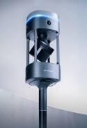
 Justin Simkins, Technical Sales Specialist at Emesent, led the Hovermap survey, processing, and alignment effort. The team deployed two systems: a Hovermap 100 and a Hovermap STX, provided by Emesent for the project.
"Usually entire site scans like this would be conducted running survey control throughout the entire cave system with survey spads and a total station for aligning scans together, like in underground mining," Justin explains. "This site, however, we are bound by very narrow passages, deep water, and a 'leave no trace' mentality; we needed to map out the cave system quickly and leave it as if we were never there."
Traditional methods weren't just impractical - they were incompatible with the site's protected status. The team couldn't install control points in a cave where even footprints are carefully managed.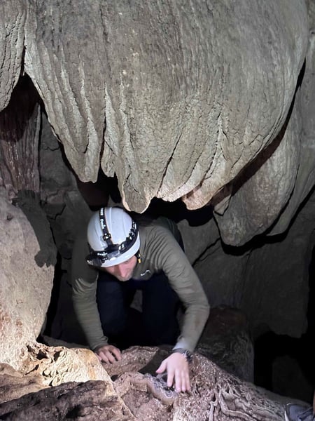 The solution was meticulous planning and Hovermap's SLAM-based cloud-to-cloud alignment. The team designed scan paths with significant overlap to eliminate drift, rehearsed scanner handoffs through tight passages, conducted scans from small inflatable rafts through deep water, and captured data while scaling steep underground cliffs—all while staying safe and leaving the resting places of artefacts and ancestors undisturbed.
"Scanning in these types of environments provides unique challenges that the Hovermap can easily overcome with foresight and planning," Justin says. "Being a significant cultural and archaeological site, we were limited by working hours, project time, animal, and environmental factors."
Over the course of the field campaign, the team seamlessly merged more than 70 scans—captured with both the higher-resolution STX and the Hovermap 100 - to produce an accurate map of the entire cave system.
The Results: A Digital Twin 1,000 Years in the Making
The Hovermap scans delivered what decades of traditional methods couldn't: a complete, accurate 3D framework of the entire cave system, from the blue pool at the entrance to the remote western passages where an intact olla - the cultural material farthest from daylight - still sits undisturbed.
The Main Chamber alone spans 4,450m², containing approximately 1,500 unique artefacts and the remains of 18 individuals. For the first time, researchers can visualize the spatial relationships between these deposits - understanding not just what the Maya left behind, but how they moved through this sacred space.
The mobile LiDAR data became the "digital scaffold" for the broader documentation project. High-resolution structured-light scans of the Crystal Maiden, altars, and skeletal remains were fused with the Hovermap point cloud, creating a multi-resolution digital twin that serves both scientific analysis and heritage preservation.
According to the peer-reviewed research published in Research Reports in Belizean Archaeology, the integrated approach produced the most detailed documentation of ATM cave to date. An interactive online version is now being developed for guides and the public - virtually opening this fragile site to audiences who could never physically visit.
Why Emesent
"Unlike with tripod-mounted TLS units, cave surveyors can crawl, climb, scramble, rappel, wade, or float with handheld mobile LiDAR scanners," the research team wrote, "enabling them to access and digitally capture portions of a cave with unprecedented speed, accuracy, and completeness."
For ATM cave, Hovermap wasn't just the best option - it was the only viable one. The combination of GPS-denied SLAM performance, handheld portability, and the ability to capture geometry without visible light made it possible to document spaces that had remained unmapped since the Maya walked away over a thousand years ago.
What took 35 years to attempt again was completed in a single field season.


Project Facts
Industry: Archaeology / Heritage Documentation
Location: Actun Tunichil Muknal, Western Belize
Products Used: Hovermap STX, Hovermap 100
Project Partners: UC San Diego, UC Merced, Belize Institute of Archaeology
Scans Captured: 70+
Cave Length: ~5km
Main Chamber Area: 4,450m²
Artefacts Documented: ~1,500
Human Remains: 21 individuals
Key Outcome: First comprehensive digital twin of one of the Maya world's most significant archaeological caves
Project Principals
- Holley Moyes — University of California, Merced
- Justin Simkins — Emesent
- Gonzalo Pleitez — Belize Tour Guide Association
- Dominique Rissolo — University of California, San Diego
- Rumari Ku — Belize Institute of Archaeology
- Josue Ramos — Belize Institute of Archaeology
- Graham Goodwin — University of California, Merced
- Kay Vilchis — Subdireccion de Arqueologia Subacuatica del INAH, Mexico
- Alphawood Foundation
- National Science Foundation (USA)
Read the full study here: Sacrifice of the Maize God: Re-creating Creation in the Main Chamber of Actun Tunichil Muknal, Belize
Moyes, Holley and Jaime J. Awe 2021. Sacrifice of the Maize God: Re-creating Creation in the Main Chamber of Actun Tunichil Muknal, Belize. In The Myths of the Popol Vuh in Cosmology, Art, and Ritual, edited by Holley Moyes, Allen Christenson, and Frauke Sachse, pp. 136-169. University Press of Colorado, Boulder.