
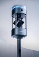


Some environments earn a reputation. When we received drawings and photos of a sewer tunnel in Switzerland, we knew exactly why the client had reached out — several leading SLAM-based solutions had already attempted this site and failed.
A 1.48km underground tunnel, roughly 3 meters in diameter, concrete-lined, with a steel sewer pipe running the length of the floor on concrete piles. Sparse features, repetitive geometry, minimal lighting. The kind of environment that pushes mobile mapping technology to its limits.
The Challenge
Tunnels are notoriously difficult for SLAM. This one was particularly so: concrete footers every five to ten meters, larger infrastructure structures every fifty, the occasional conduit or pipework at around every hundred meters. Salt formations on the walls — where groundwater had leached through the concrete and crystallized — added some variation, but barely. Everything looked the same, and that's exactly the problem.
SLAM — Simultaneous Localization and Mapping — works by continuously reading the geometry around it to establish where it is. Without enough distinct features to detect and re-identify, localization starts to break down and error accumulates. Think of it like being placed inside a steel pipe where everything looks identical. Even a person would quickly lose their sense of where they were. The algorithm faces the same challenge.
The client had already invested time and money in alternative solutions, and none had delivered usable results. Slip and drift, every time.
They also had a specific requirement: no ground control points. They needed a solution that could produce accurate results without GCPs or georeferencing — just walk in, scan, and deliver.
12 Hours and One Chance
Our field specialist drove 12 hours to reach the site. The night before the scan, the client sent through photos of the tunnel interior.
"I thought, this does not look like a SLAM-friendly environment," Jeremy Sofonia recalls. "I had to start thinking about how I was going to manage expectations."
What he didn't know yet was that the client's expectations were already low. By the time Jeremy arrived on site, the client had seen enough failed attempts to assume this one would follow the same pattern.
There was no guarantee it wouldn't be a wasted trip — just confidence in the technology and a methodical approach to a difficult environment.
When you're unsure about a SLAM environment, you start handheld. You walk it slowly. You let the sensor do what it does best. That's exactly what we did. Walked the full 1.48km down, turned around, and walked back — a single continuous scan, using nearly the full two hours of available battery life.
Where Others See Featureless Walls, We See Data
The key was recognizing what was there and giving the algorithm the best possible chance of working with it. 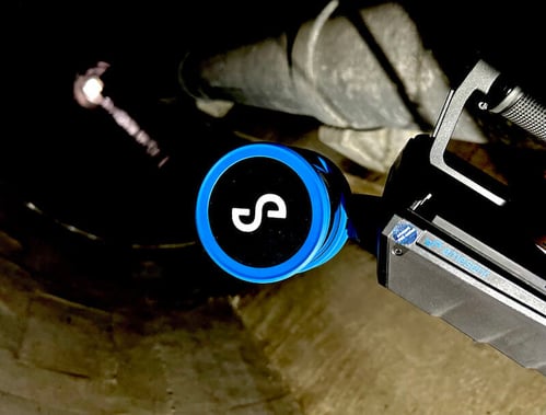
Resolution is everything in a challenging environment. The denser the point cloud, the better the chance of detecting and tracking the small features that are present — concrete footers, pipe structures, the faint texture of salt formations on the walls. Walking slowly maximizes point density. Carrying Hovermap handheld, rather than in the backpack mount, meant the sensor could see both forward and back simultaneously, linking features already passed to those still ahead.
"Whatever features were in the environment, I wanted as high a resolution on them as possible," Jeremy explains. "So I walked slowly, kept it to my side so it could see forward and back, and tried to link the features together."
The client walked alongside him, watching the point cloud build in real time on Emesent Commander.
Processing and Results
The initial processing showed some slip — not unexpected in a tunnel of this length with so few features and no GCPs to act as guardrails. A few adjustments to the processing settings, and the point cloud came together cleanly.
The client took a couple of days to complete his technical evaluation. When he came back, the data had met the accuracy requirements that every previous attempt had failed to reach.
"He could hardly believe that he had finally found a piece of equipment that could handle that task," Jeremy says.
The Takeaway
 Not every scan goes smoothly on the first attempt. What matters is having the technology capable of capturing the data in the first place, and the processing flexibility to refine the results.
As Jeremy puts it: "We can tell people Emesent SLAM is the best — but that only carries so much weight. It's projects like this where we can point to exactly why. We know where our competitors have struggled, and where we've been successful where they've failed."