AUTOMATED GROUND CONTROL
FOR HOVERMAP
UNRIVALED SLAM ACCURACY
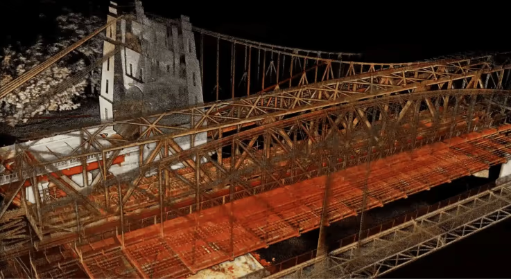
Emesent’s Automated Ground Control is an innovative feature that further increases the accuracy of Hovermap point clouds and enhances the capabilities of its SLAM-based mapping. It enables new scanning opportunities and use cases, including long, large, and feature-poor assets such as roads, and tunnels – which where previously a challenge for SLAM-based mapping.
AUTOMATED GEOREFERENCING
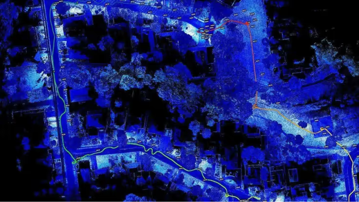
Using machine learning, Ground Control automatically detects reflective ground control targets and uses these to both georeference the point cloud and improve accuracy. Targets are detected without needing to stop or place Hovermap on them, enabling non-stop scanning – a first for SLAM-based mobile mapping. Scanned survey coordinates are input for processing by simply selecting the file, minimising manual error and streamlining the workflow, eliminating manual error and streamlining workflow.
Streamlined Workflow
1. Place your targets
No more fading painted crosses or easily damaged foam spheres! Emesent’s ground control targets are durable and easily placed and left in place for repeated scanning. Emesent’s spigot-mounted discs are available, or the reflective disc targets can easily be sourced or made.


2. Survey the targets
Use a total station or GPS rover to survey in new target locations. Placing Emesent’s spigot-mounted targets into existing survey collars ensures the target centers coincide with existing survey prism locations, avoiding the need to resurvey.
3. Conduct a non-stop scan
Machine learning is used to detect targets automatically in the scan during processing, so there is no need to stop or place Hovermap on the target, minimizing your scan time.

4. Process the data
Select to input the raw scan data and survey coordinates into Emesent’s Aura software. Ground Control automatically detects the survey targets and applies a non-rigid transformation of the point cloud, giving you the most accurate results.
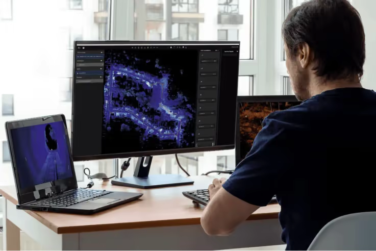
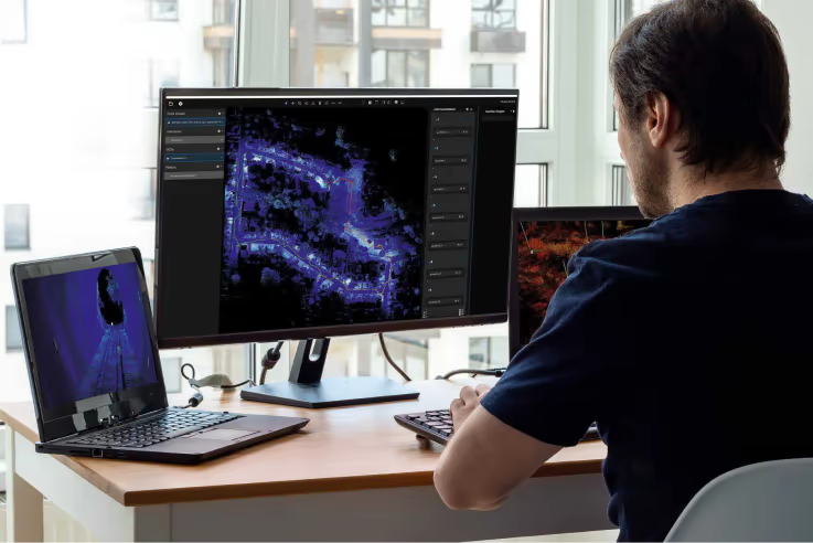
5. Confirm the results
Processing can be run automatically end-to-end without interaction, or the target detection and constellation matching results can be visualized in Emesent’s point cloud viewer in Aura for confirmation or adjustment.

6. Output survey grade results
An accurate, georeferenced Hovermap point cloud is ready for use.
Achieving survey grade with SLAM-based LIDAR Mapping
Watch this on demand webinar to hear from Emesent CEO and cofounder Dr Stefan Hrabar and Emesent Technical Sales Manager Jordan Herrmann on how the Automated Ground Control feature revolutionizes mobile mapping and provides unrivaled SLAM accuracy and workflow efficiencies.